
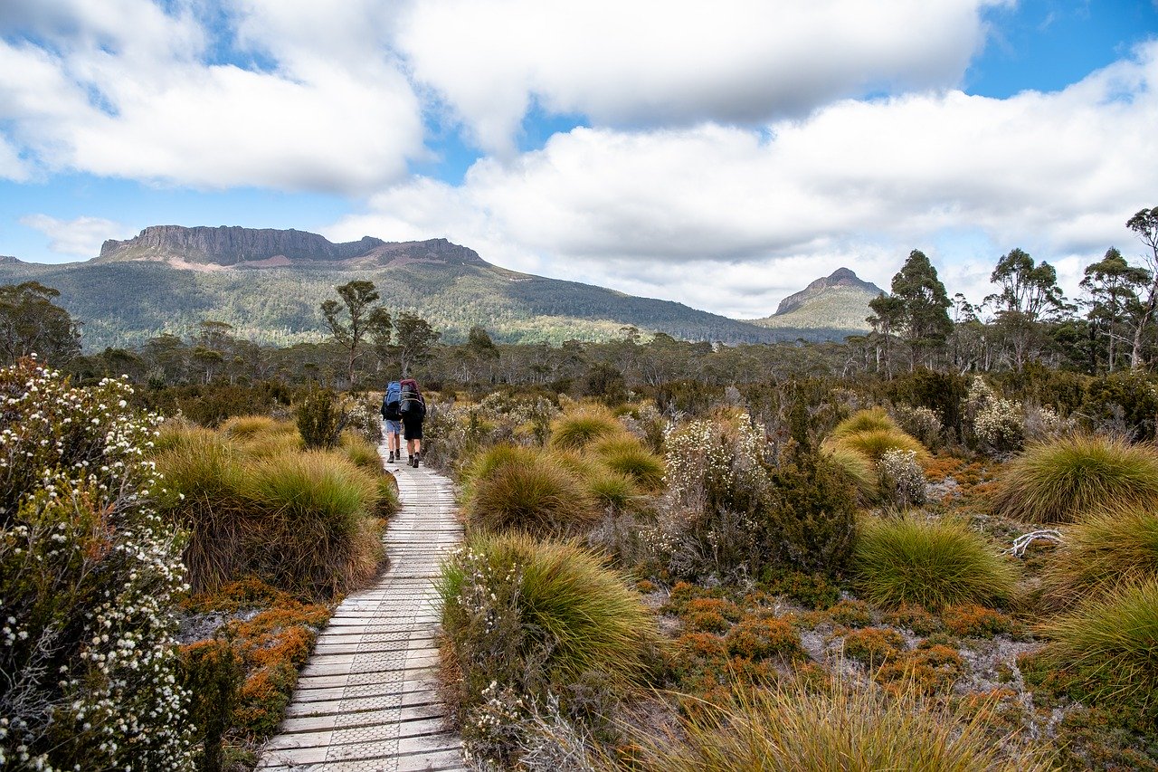
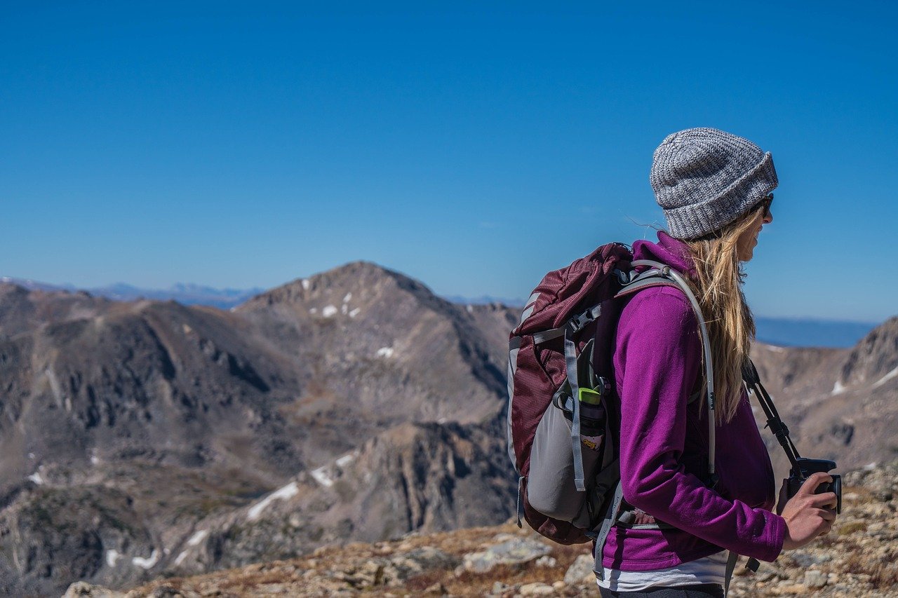
The classic compass and map have been the go-to tools for backpackers in the wilderness who have needed a little help with navigation.
Times have changed, and people can avoid running into problems with reading coordinates and get back on trail easily with these apps.
These apps are a godsend for any adventurer, even if you’re just checking your location or have trouble finding a certain spot.
Why You Should Use Hiking Apps
Plan a Hike
Apps can be quite useful in providing you with terrain and elevation information about a particular trail when you’re planning a hike. Perhaps you want to know where certain things, such as water points and campsites, are located within a particular distance. All of these landmarks and locations can be found with a hiking app. Hikers will even provide reviews and information about the apps they’ve used.
Find New Trails
Top trails near you, along with pictures, mileage information, updates, difficulty distinctions, and reviews can all be found on MapMyHike, AllTrails, and similar apps. Searches can be done within the apps and narrowed for a particular focus.
If you want something like a low difficulty hike with a waterfall view and a 6-mile length, all you have to do is apply the necessary filters, add your location, and you’re all set. A list tailored to your likes is at your fingertips.
Socialization
Do you want to find other hikers and even have a competition with them? Apps have games and prizes that can be unlocked through challenges, and on a global scale, you can communicate with hikers.
Navigation
The backcountry is notorious for having areas where it’s impossible to get cell reception. For this reason, maps and trail guides need to be accessed offline, which is why they can be saved and downloaded through apps.
You can even find out where you are with compasses and GPS features that are found in apps. For adjoining trails and ones without clear markings, this can be useful.
Information About Stars, Flora, and Fauna
Have you seen an animal while hiking on a trail and have no idea what it could be? Are you curious about whether you’ve touched a problematic plant? Do you want to know more about a bright star or mountain in the distance?
Through photo recognition, hiking apps make it possible to quickly identify many things you find on the trail.
Safety
Are you going to go hiking alone for multiple days? You and your loved ones can feel a little better about the hike if you use a survival app.
Cairn is a good app for this and there are others like it. The app lets others see where you plan to hike, and if you don’t meet the check-in time that has been set beforehand, notifications are sent out. Information about poisonous plants, animal locations, and more can be found in survival manual apps.
Performance Sharing and Tracking
Apps can track hiking stats in a similar manner to running apps. Hiking pace, elevation gain, burned calories, and total distance will be recorded by the app and presented into an easy to read manner once the hike has been completed. You can even save the stats and share them.
Navigation
MotionX GPS
Free marine charts and topographical maps can be found with MotionX GPS. The app has the ability to navigate using GPS technology without cell service, but it has waypoint limits that must be increased with in-app purchases. Maps and extra data will have to be downloaded before taking the hiking trip if you plan to use the GPS without cell service.
Mountain Hub
Information about terrains and weather can be obtained through hikers, as well as climbers, hunters, and skiers through the Mountain Hub app. Contributor information is compiled through the app, making it easy to see trail data.
While the app is free, a premium version exists that costs $3 each month or $25 for a year. This Pro version of the app has added features, such as the ability to download layered aerial and topographical offline maps, and the option of marking interest points and hazards.
Google Maps Offline
Google Maps, which isn’t an app specifically for hiking, does work quite well for navigation just about anywhere in the world. For hikers and those that like to through the backcountry, the app’s mapping system and database are extensive and easy to use.
Google Maps is something that every hiker and backpacker should have, especially since panoramic views of locations can be seen with it, and routes can be planned.
OS Maps
Ordnance Survey is a name that British hikers in the UK know well due to their centuries of mapping. The maps provided by Ordnance Survey are some of the most detailed maps that a hiker could hope for in the UK. The apps, along with more features, can all be found in the Ordnance Survey app.
While there route plotting feature leaves a lot to be desired, the app is among the best when it comes to navigating using highly detailed maps.
There’s also a neat augmented reality feature that can be used on landscapes to find mountains, water, forests, settlements, coasts, and even transports that are nearby.
Trails & Guides
AllTrails
AllTrails, which is one of the most popular navigation apps that exists, makes it possible for users to always know where they’re going by giving them access to its database. From the U.S. to Canada, there are more than 50,000 hiking trails that are constantly being updated with information through the AllTrails app. It’s even possible for custom trails to be created and shared among users of the app. Trails and maps can be downloaded and saved when users purchase the advanced version of the AllTrails app.
Gaia
Gaia is a favorite app among many because of the features that it has, along with its satellite, road, and topographical maps that are full of detail. Geotagged photos can be taken with the app, waypoints can be marked, and hiking tracks can be recorded with the GPS in real time. The entirety of the parks and trails in Gaia’s database can be searched through in the app.
If you have multiple devices, your data can be saved and synced between them, and the iOS version of the app has been updated to look differently on an iPad and makes it possible to plot travel points from your home. All of these impressive functions come at a cost of $20, and given everything that Gaia can do, professionals and amateurs agree that this price is worth it.
Hiking Project
REI created Hiking Project to act as a database for many trails, with more than 35,000 being accessible through it by hikers and backpackers who are eager to hit the road. You can easily figure out where to go and what to see using the included waypoints and detailed maps.
Regardless of how long your trip will last, you can still avoid getting lost by using the app’s on-trail navigation features. Regular updates are applied to the app as conditions on the trail change, and there is information about how to drive to locations, making it easier for travelers to navigate to them.
Maps 3D Pro
While there are a lot of map apps on the market, one of the best for hikers to use is Maps 3D Pro. This app helps you get an idea of where you are headed to by using 3d mapping.
Areas of terrains that are hard to see can be visualized in the app, as peaks and contour lines are well defined. Hiking routes can be saved and downloaded for offline use in the app.
ViewRanger
Apps that have advanced GPS features are some of the most useful ones that hikers can use, and ViewRanger is an app that offers this in an easy to use package. For those that want something similar to the GPS navigation that is provided by a satellite-based device, the app is a great equivalent.
The app is so good at its job that it has been used all over the world by various search and rescue teams to help locate people and areas that can’t be easily reached.
The app is perfect for basic uses who want to navigate and track their hiking, and they can download maps for offline use. For people around the world, ViewRanger is great for offering a large database of routes for hiking.
Chimani National Parks
This app covers all of the 59 National Parks that can be found throughout the United States. It has information, pictures, and updated news on each park. There is a master app that has maps of locations, but for each of the individual parks, there are also apps offered by Chimani that covers everything about them. This includes well-known parks like the Grand Canyon or Yosemite.
For each app, there are trails, interest points, audio tours, guides, and even offline GPS support. There are even guides for locations and information about events led by Rangers. If you’re going to plan a trip to one of the National Parks in the U.S, this app would serve as a great tool.
REI National Parks
One of the best guides for National Parks in the US is the REI Co-op Guide, which has a lot of information about hiking and sightseeing. There is trail data, ratings for hikes based on difficulty, profiles for elevation, tours, food locations, camp, and lodging sites, and seasonal information.
There is a best-of option that sorts the trails by ratings based on the community, and a map view for locating hikes. It is a free app, but it offers as much as a paid-for app and can be used for many parks such as Yosemite, Zion, Yellowstone, and any other that can be found.
Guthook Guides
Thru-hikers will really love to use the Guthook Guides app. This app has more than 10,000 defined waypoints and has many detailed maps and miles of trails to see. The Pacific Crest Trail, Appalachian Trail, and Continental Divide Trail are particularly great to explore with this app.
Shelter locations, road crossings, campsites, parks, water sources, peaks, and more can all be found with this app, and town guides can be used to find shops, restaurants, post offices, and other locations that have many of the modern amenities that people use. Custom hiking routes can be created through the app and comments and photos can be shared as well.
Record
MapMyHike GPS Hiking
Are you in need of an app that can track more than just your location? If your answer is yes, then you might want to invest in this unique app. That is because you can use it to track your location as well as your cycle or hike.
Moreover, the app also provides a detailed result of your journey. Some of the details included in the feedback result are distance covered, average pace, and the number of calories burned. Even though this app is geared towards exercise, you can use it to find local routes and track your time.
Furthermore, you can access more interesting features such as real-time tracking, audio coaching, route recommendations, and analysis of your heart rate, if you subscribe to the premium version for only $6 every month.
Ramblr
This amazing app has proved to be reliable when it comes to navigation and tracking. Hikers can use this app to share their experiences with relatives and family by connecting online. Other interesting features that come with this app are live maps and real-time tracking. The maps also have additional features, which makes it easy for hikers to find their way.
You can also use the same app to measure distance traveled as well as speed and altitude. Another advantage of using this app is that the maps are downloadable using a WiFi connection, which makes it more reliable when traveling.
Map My Walk
The Map My Walk app is a community-based fitness and walking app that allows users to time and record their activity. The app can be used to track nutritional and calorie intake. Furthermore, the app allows you to connect with relatives and friends so that you can motivate each other.
You can also access more advanced features such as training plans and heart rate analysis if you sign up for the premium version for only $5.99 a month and $29.99 for one year. This app is considered to be the best for urban walks since it is easy to use and reliable.
Map My Tracks
This particular app can be used for fitness and hiking purposes. That is because the app relies on GPS tracking and other features to record and track the distance you have covered.
Furthermore, the app also generates a report on fitness details, which include vital data such as your heart rate, calories burned, average pace, and even elevation gain. You can also use the MapMyTracks app to set activity goals and time yourself.
Walk the Distance
Walk the distance is an incredible app that is usually used for hiking and also for other outdoor activities such as walking.
With the help of this app, you can track your hiking progress and determine the distance covered. The application saves daily reports in the “history” tab, and you can use this information to improved your hiking activity. You can also use Walk the distance to set checkpoints and even share information with family and friends.
Peaks

PeakVisor
PeakVisor can be used to find directions and identify places. If you are not sure of where you are, use the app to identify your current location by taking footage of the nearest peak. All you have to do is hold up your phone and capture the view of the landscape that is in front of you. The PeakVisor will identify the peaks and label them at the same time.
The app can be installed on smartphones since the app relies on the phone’s camera to generate results. Besides being used to identify features, you can also use the same app to find your way thanks to the altimeter and 3D compass featured in the app.
PeakFinder
PeakFinder does more than just guide you on where you need to go. You can use this app to learn about natural features that surround you, such as mountains and landscapes.
All you have to do is hold the camera and capture the image of what you want to learn about. The app will generate a report or quick facts of the image, including its name and history. Moreover, this particular app also supports real-time rendering of the landscape and its surrounding.
Knots
Animated Knots
The animated knot is a unique app that delivers great results when it comes to finding new places. Animated Knots provides useful information such as a description of each knot, strengths, alternatives, and weaknesses. Users also have the privilege of marking their favorite knots when exploring. Another advantage of using this app is that it has a step-by-step guide on how to deal with various knots.
Knots 3D
The Knots 3d features more than 135 knots. The Knots 3D is usually used by fishermen, firefighters, and arborists in different regions around the world.
The app allows users to watch each knot drawing itself and can even use a finger to create the knot to discover the starting point as well as the endpoint.
3D knots can be arranged according to their category (fishing, boating, and climbing) as well as type (loop, stopper, bend). Moreover, each point provides additional information such as tying pointers, reliability, strength, Ashley reference number, and structural information.
Tools
Spyglass
This is considered to be the best application for outdoor activity. That is because Spyglass comes with an advanced GPS toolkit, which is used to track natural features.
This amazing app has a unique display, a gyrocompass, altimeter, speedometer, astronomical object finder, inclinometer, a sextant, and an angular scientific calculator.
Weather
Weather Live
Weather live a reliable app that can be used on different platforms. Furthermore, this app has the best display and is also easy to use. The app provides real-time weather scenes in different regions. It also has a customizable layout for improved display.
The app can be used to analyze meteorological data such as humidity, wind direction, visibility, precipitation, and pressure. Weather live also has animated weather radar and enhanced rain maps and a satellite for the worldwide cloud. With this app, you can predict the weather and record data.
Safety
Cairn
The Cairn app is also referred to as the “the best hiking safety app” and is considered to be vital took for those who love engaging in outdoor activities.
You can use this app to discover a coverage that has been found by others and also share information or updates with those who are close to you.
The app also allows users to send updates to different contacts after returning from each trip. Another benefit of using this app is that you can download topo maps and use them when offline. Moreover, you can access more features if you sign up for the premium version.
SAS Survival Guide
There are various military survival apps or guides that are offered online (such as Army Survival Guides, which is for android). However, there are other apps that are more advanced and reliable when it comes to finding new features and locations, and a good example of such an application is the SAS Survival Guide. This amazing app was discovered by the SAS instructor and soldier.
The app possesses both video and text content published in over 400pages. The content is of high quality and is obtained using various data and tools such as a compass device, Morse, photos, and videos. You can use the app as a reference guide and also a learning tool.
First Aid By British Red Cross
The first aid app is a product of the British Red Cross. This app gives you the privilege of accessing safety information as well as expert advice on emergency cases.
The application is also designed with diagrams, videos, and interactive quizzes. You can also use the app as a step by step guide for various emergencies.
Offline Survival Manual
Survival manual is an offline app that provides useful information on how to survive in the wilderness. This app can teach you who to build a shelter and even start a fire. Moreover, the offline app also provides tricks and tips for packing survival tools and for gathering food.
Another interesting feature found on this app is the psychology section, where you can discuss various topics such as how to manage stress, fatigue, and isolation.
Share
Yonder
If you are happiest when enjoying the great outdoors you likely have the desire to talk about your wanderings with other fellow explorers. Yonder is a great way to easily share all of your outdoor highs whether they are related to camping, hiking, or biking. It is basically a social media network for outdoor lovers.
That being said, Yonder is a lot more than just a social app, it is also very much aimed towards exploration and lets you see what experiences are available close to your location. It’s also great for giving inspiration for where to go since you are able to view shared images.
Identification
Audubon Birds Pro
If you would love to be able to identify birds that you see while you are out hiking, this is an app that you definitely need. You will find the current AOU Checklist of North American Birds, as well as 808 species with descriptions and pictures provided. The app also lets you listen to the sounds made by various birds so that you can identify birds song when you hear it.
The app also makes use of the Cornell Lab of Ornithology database to outline migratory maps and recent sightings. The easy-to-see guide of bird alerts makes it a good value app for Android users. If you find this app is up your street then you may also like the other apps by Audubon, including how to identify various trees and insects.
Leafsnap
Of course, birds aren’t everyone’s interest -you may be more of a tree junkie. If that is the case then Leafsnap needs to be on your download list.
This joint project by Columbia Uni and the University of Maryland, as well as Smithsonian Institution, makes use of vocal recognition to identify trees y their leaves – all you have to do is take a picture and the app will identify the tree.
It’s not just the leaves that the app recognizes. You will also find excellent quality pictures of fruit, flowers, and bark, all of which can make the identification process easier.
Seek by iNaturalist
Do you want to know more about a plant or animal that you find along your path? You will find the answer with this app. Being the biggest community for naturalists the world over, iNaturalist has designed Seek to hekp you discover more about a plant or animal you have just taken a picture of.
The app also makes use of GPS to use your location to aid in narrowing down the species that are currently in the area. You will also be able to access information about where other uses have recently spotted the same species and the most popular season for sightings.
Stargazing

Sky Map or Star Walk
Could there be anything more enchanting after a day’s hike than to lie back and gaze up at the stunning night sky? Being far away from the city lights makes stars way easier to see and apps like this one can be a great help. As usual, there isn’t one great app for all platforms, that’s why we have found options depending on which platform you use.
For Android users, the Sky Map app is free and a great choice. Positions of stars and planets can be found by holding your smartphone towards the sky. Constellations are also marked and the app even lets you travel in time to see how different these were in bygone years.
If you use iOS, Star Walk is also a very special app. It allows for night mode which makes things much more relaxed on the eye and will identify planets, stars, constellations, and satellites, there is also a time machine function on this app too. The app has beautiful photos to check out, as well as a star gazing community and information about upcoming celestial events.
Sky Guide
The augmented reality on Sky Guides provides an excellent experience and plenty of practical tuition as well. You can use the app offline to identify stars, planets, galaxies, and constellations from your phone screen. The app also allows you to choose something in the sky and learn more about it as well as to search for a specific planet or stars.
A great feature of this app is the calendar that highlights future meteor showers, moon cycles, and also a news stories section that relates the latest NASA findings.
Geocaching
Geocaching
Geocachers the world over love this app. Whether you are a novice or a pro at geocaching, this app will bring the adventure to you.
You will find details of geocaches in your location, as well as descriptions of attributes and what has recently been happening. The map, compass, or driving directions will lead you to the cache and you can also learn about trackables (game pieces which make their way from cache to cache).
Geocaches can also be filtered using specifics such as terrain, difficulty, distance, and so forth.
Campgrounds
Camp Finder
This app is pretty self-explanatory. There are more than 17,000 campgrounds listed, as well as RV parks, all over the U.S. so it’s easy to see what is close at hand.
The results can be filtered by amenities, activities, discounts, and so on. This app makes use of information from CampingRoadTrip.com so you get up to date information, as well as reviews and photos.
Google Maps is integrated so navigation is easy and there is the option to save favorites for your future use. The app is priced at $3 for Android users and $4 for iOS users.
Helpful Tips & Tricks

Do I Even Need a GPS Device?
To put it short, absolutely. Navigation is crucial when you find yourself in the backcountry. Without having something to help you navigate, you will quickly find yourself getting lost which can be dangerous. By having a GPS that you can rely on in combination with your map and compass, you should be able to pinpoint your exact location at all times which can come in handy when you are looking to stay safe during your trip.
You will find yourself constantly being uncertain about where your next campsite is, where the next trail junction is, or even about where the next landmark is without one. This can lead to very stressful situations and you might even find yourself panicking because of the uncertainty. However, when armed with a phone GPS application, you will be able to answer each of these questions by merely looking at the app.
As soon as you figure out the in’s and out’s of using the app and all of its features, it can prove to be a must-have even on the shortest of hikes.
For us, being able to leverage our phones into full-on GPS devices has completely changed the way we approach our trips. In fact, we could argue that these apps have been the most critical innovation in the past few years and it has made the biggest difference to our backpacking setup and experience. For those who enjoy hiking as much as we do and who consider themselves to be hiking enthusiasts, that is certainly saying a lot.
Why You Should Use Your Phone?
Garmin is probably the most recognizable brand when it comes to handheld GPS devices. However, handheld GPS devices aren’t the most affordable nor are they as easy to use as mobile applications. Likewise, they also prove to be rather bulky in comparison because you are adding yet another piece of equipment to bring along with you during your trip.
This is why it is better to leverage your phone’s GPS capabilities. After all, you are already bringing your phone with you anyways and you already own it. Along with this, your phone offers versatility. After all, you can use it as a camera during your trip, play music with it, use it as a flashlight, and a variety of other ways.
Therefore, if you can learn how to leverage your phone as a GPS device for your backpacking trips, you should be able to add even more value to the piece of gear that has already proven to be an invaluable addition to your backpacking setup.
How Does Your Phone’s GPS Work?
While GPS systems are inherently rather complicated, here is a brief and easy to understand explanation. GPS actually stands for “Global Positioning System.” To put it simply, it is a network featuring 24 active satellites that are used for navigation. Your phone has GPS capabilities in it. Your phone acts as a receiver and it communicates with the satellites in order to effectively pinpoint your location. Because of this, it can help you figure out your exact location no matter where you are.
No Worries If You Don’t Have Service
A lot of people might be under the assumption that they need to have cell phone service for their GPS to prove useful. The fact is, you don’t. Because GPS uses satellites, you aren’t going to need to be in a range of cell phone towers. Therefore, you will be able to use the GPS functionality even when your phone has no service. This is something that you will find yourself very thankful for as you will find it very difficult if not impossible to get cell phone service while out in the wilderness.
While your GPS system will work even without service, you should always look to download the regional maps prior to leaving for your trip. If you don’t download the maps beforehand, your phone is still going to be able to locate you, but you would likely have a difficult time seeing where you are as your map will be rather blurry.
Along with this, to get the best results from your GPS system, your phone needs to have a clear path to the satellites. Therefore, you might find your GPS acting faulty if there is a lot of obstruction blocking your GPS from getting a good signal. With that being said, you shouldn’t have too much trouble getting a good signal as a lot of the phones nowadays have excellent GPS coverage even in dense areas.
How to Use GPS Navigation Apps When Hiking?
As mentioned, you want to download the regional maps for offline use prior to heading out. As soon as you have downloaded the maps, you will be able to have your location show up on the map while you are in that area.
When it comes to figuring out which maps to download, we always stick to downloading two different types of maps. First, we download the detailed map with everything from trails to trail-heads and even important way-points indicated. We also download a satellite map of the entire area which helps us keep an eye on the terrain that we will be facing and it even helps us scope out the good places to set up our campsites.
When it is available, we look to download the GPX tracks for the routes that we are looking to travel to. This is especially helpful if you are planning on going off-trail at all.
Conserving Your Battery Life
One of the things you should be keeping an eye on is your phone’s battery life. After all, a dead phone is not going to provide you with any value. Therefore, you should look to conserve battery life as best possible when traveling in the backcountry.
There are a few things you can do to successfully preserve your battery life.
- Put your phone in “Airplane Mode.” This will help to minimize battery loss due to your phone constantly looking for a signal.
- Don’t record your tracks, this can really drain your battery.
- Close every app on your phone that you aren’t using.
- Turn your phone off when you aren’t actively using it.
- Keep your phone insulated. Ideally, place it in your sleeping bag while sleeping. This can keep it from draining due to being exposed to colder temperatures.
- Turn off location services for every app not in use.
- Utilize solar chargers while traveling.
Charging Options
You will also want to bring along with you a 3-inch charging cord to charge everything from your camera to your phone and a variety of other electronics. A universal cable should be all you really need.
Test It Prior to Heading Out
As with anything you are bringing along with you, test out your GPS application prior to going on the trip. You want to learn how to use it and be certain that it is working before heading out.
Download various maps to your device and look to go on a short hike to practice. Continue to reference the map until you feel comfortable using it as a means for navigation.
Also, keep an eye on your battery life during the short hike. You should be able to tell whether or not it is sufficient and it can give you a good idea of what kind of charger you will need to bring along with you.
Don’t Rely Solely on Tech
Technology isn’t the most reliable. It will fail at times. Because of this, you don’t want your phone to be your only means of navigation. We have created a tutorial video that can teach you the basics of wilderness navigation.
Along with the various tips we discussed, you should always be carrying a physical topographical map and a reliable compass. After all, your physical map isn’t going to run out of juice and it won’t fail. Whereas, your compass isn’t going to fail either.
Keep these two essential items with you wherever you go. Even if you never bring them out during your trip, you want to have them as preferred fallback options.
In the Event of an Emergency
Your GPS navigation app is going to be there to help with your location. However, in the case of dealing with an emergency, you won’t be able to call for help. Because of this, you should look to include a satellite messaging device in your backpack. This will help you send out simple yet effective messages including an SOS signal by only pushing a button without requiring service from cell towers.

- 15 Best Free Online Virtual Summer Camps for Kids (2022) - July 6, 2021
- Expert Roundup: Advice to Mitigate the Effects of Coronavirus - March 22, 2021
- Best Gifts for Travelers - January 15, 2021